Groundwater Development for Small Towns Water Supply, Ghana
The Danida funded Small Towns Water Supply and Sanitation Component of the Community Water & Sanitation Agency (CWSA) is setting up water supply schemes for a number of small towns in the Greater Accra and Eastern Regions.
As international hydrogeological adviser to CWSA, Andreas de Jong was responsible for locating and developing sustainable groundwater sources for seven small towns. An important aspect of the project was the on-the-job training of local counterparts, and the development of successful groundwater exploration strategies.
According to CWSA statistics (2002), the national coverage for potable water supply in both rural communities and small towns in Ghana is currently 41%.
Coverage is defined as:
- all year round supply of potable water
- one borehole or stand post per 300 people or one hand dug well per 150 people
- a minimum of 20 litres per capita per day
- the system is community owned and managed
- the maximum walking distance to a water point is 500 metres
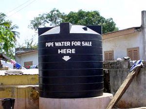
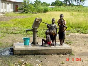
Houses in the urban areas lucky enough to have a piped water supply often share this benefit - at a price. Water can cost from 200 to 700 cedis per 18L bucket. (1.3 to 4.5 $/m3)
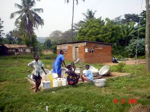
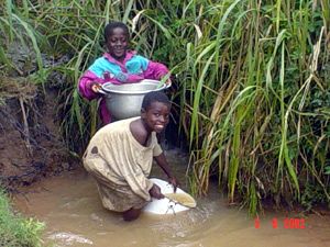
For some, waiting at hand pumps or paying for water from tankers is not an option. Water is collected from other sources such as streams. This is usually the job of women and children.
Our approach was to obtain a good hydrogeological overview of the project area, and then to develop appropriate groundwater exploration strategies.
One of the first tasks was to find the latest geological maps of the project area at the Geological Survey Department. Some dated from 1945.
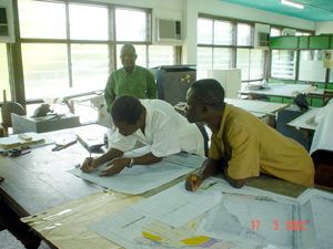
The maps were digitized and incorporated in a GIS.
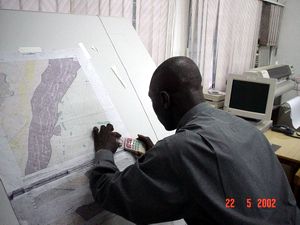
Available information such as borehole location, pipeline routes and population centers were added to the GIS.
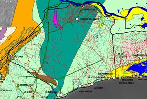
A Landsat 7 image was georeferenced from GPS positions collected in the field.
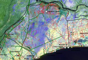
Existing data was updated with a baseline survey of water resources.
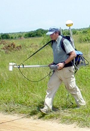
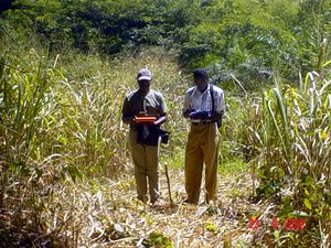
Modern geophysical equipment was introduced to the project area for comparison with locally available technology. Here Andreas is collecting magnetic data using a Geometrics G-858 cesium vapor magnetometer. Data points collected every 1/10 of a second were located in real time by differential GPS.
Although the high tech approach proved to be faster, a thorough hydrogeological overview using modern facilities such as GIS, combined with a more stringent quality control of conventional geophysics proved to be the most cost effective answer.
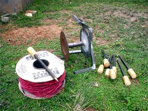
Under our supervision, old DC Resistivity accessories were replaced by locally manufactured electrodes and reels. This approach is considered sustainable as it encourages local enterprise and consumables can be replaced at a fraction of the cost of importing them from abroad.
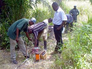
Capacity building of Ghanaian geophysical crews focused on quality control procedures to ensure optimal data quality. This included simple tricks such as the plotting of data in the field, single instead of stacked readings, and always applying water to the electrodes.
Very low frequency (VLF) measurements are a fast way to find fractures, provided overburden thicknesses are thin and the fractures are orientated in an optimal direction.
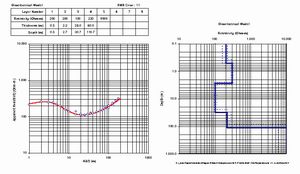
The resistivity profiling data was inverted...
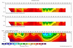
...and the Vertical Electrical Soundings (VES) modelled using Excel based software.
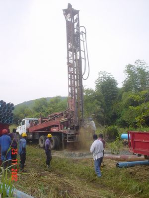
Once good drill sites had been located, test drilling was initiated.
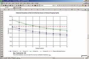
Successful boreholes were subjected to variable rate, 72-hour constant rate and recovery pumping tests.
The sustainable yields of the boreholes were estimated. The interference effects on other water sources were predicted for a range of intermittent pumping cycles at various abstraction rates.
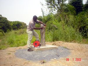
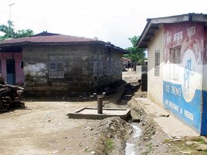
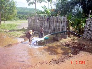
Following the final inspection, the boreholes were handed over for incorporation in water supply schemes for small towns with populations of 2,000 to 10,000.